By Nolan Sawatzky, MWF Manager of Conservation Stewardship
Surveying big game populations in Manitoba is a crucial task for wildlife management and conservation efforts. Various survey methods have been employed to gather essential data on population size, distribution, and habitat use. In this article, we will explore and compare three different survey methods currently being used in the province of Manitoba: traditional helicopter surveys, fixed-wing infrared surveys, and remote drone surveys.
1. Traditional Helicopter Surveys:
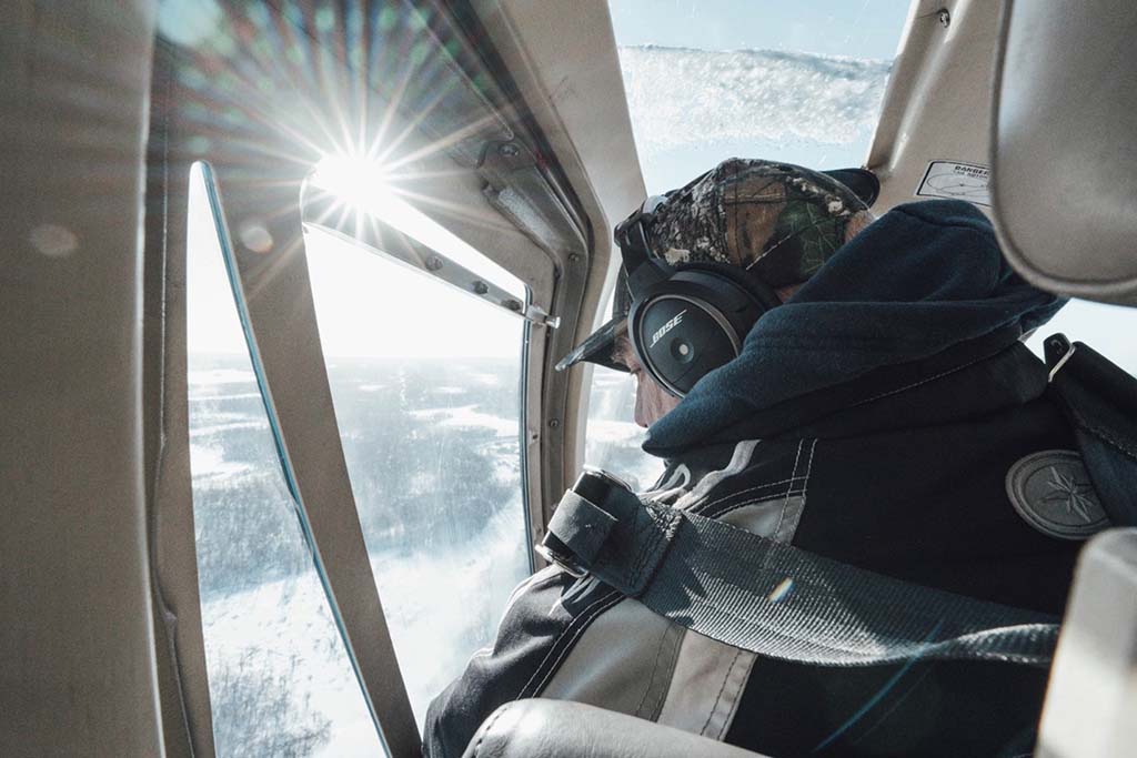
Helicopter surveys have long been a popular method for wildlife population estimates. In this method, a helicopter is flown over the study area, and observers visually count the number of big game animals they see. This method provides a comprehensive aerial view of the landscape, allowing for a quick assessment of population numbers. However, it can be costly, time-consuming, and potentially disruptive to the animals and their habitat. Additionally, weather conditions can greatly impact the accuracy of the survey results. Helicopter surveys have been the dominant method for assessing big game populations in the province over the last ~30 years. While helicopter surveys offer unique benefits and perspectives in a smaller survey area, with the emergence of newer technology, this method is no longer the most effective way to survey a large study area.
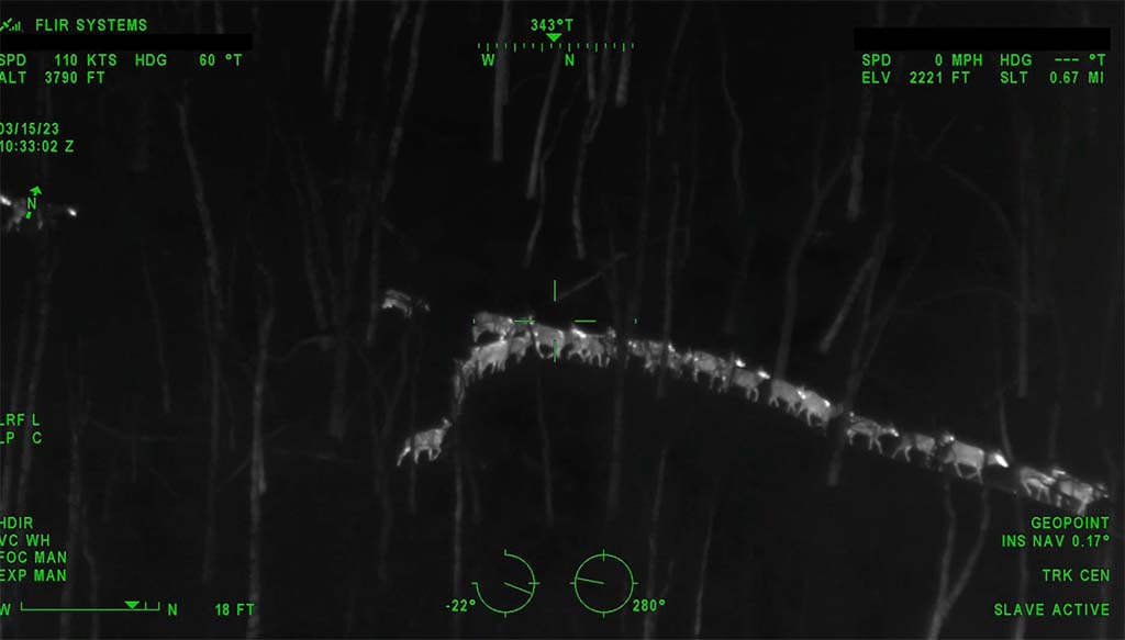
2. Fixed-Wing Infrared Surveys:
Fixed-wing infrared surveys utilize thermal imaging technology to detect and count big game animals. Infrared cameras mounted on airplanes capture the heat signatures emitted by animals, making them visible even in dense vegetation or during nighttime. This method offers several advantages over traditional helicopter surveys. It is less expensive, covers larger areas in a shorter time, and reduces disturbances to the animals. Moreover, the infrared technology allows for accurate population estimates by detecting animals that may be missed during visual surveys. However, this method requires skilled technicians to interpret the infrared images accurately. With the small crew and high quality data, this survey method provides the best quality data currently available when surveying large remote areas.
3. Remote Drone Surveys:
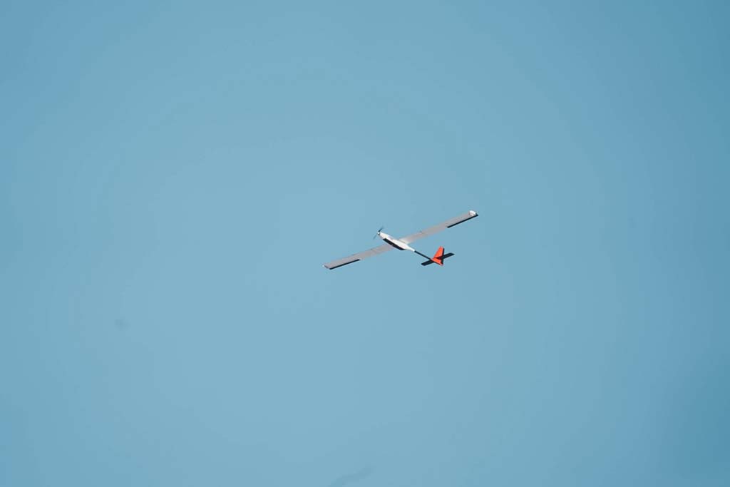
With advancements in technology, remote drone surveys have emerged as a promising method for big game population monitoring. Drones equipped with high-resolution cameras can capture detailed images and videos of the study area. These images can then be analyzed to estimate population size and distribution. Remote drone surveys offer several advantages. They are cost-effective, flexible, and provide access to hard-to-reach areas. Drones can be easily maneuvered, allowing for targeted surveys in specific locations of interest. However, weather conditions such as strong winds or rain can limit the effectiveness of drone surveys. Additionally, the need for skilled drone operators and image analysis expertise should be considered. Remote drone surveys provide an exciting glimpse into the future of wildlife surveying. The primary limitation of this method is flying beyond visual line of sight. Currently, unless a special operating permit is acquired, pilots are legally required to fly within visual line of sight of the aircraft at all times. This poses a problem for surveying areas without road access. While this method is not yet suitable for large remote areas, it provides numerous distinct advantages over the traditional helicopter surveys with its silent operation and infrared technology.
The MWF worked with provincial wildlife biologists as well as independent wildlife aerial imaging specialists deployed across the province to understand the process behind managing wildlife populations — Watch our in-depth video on Big Game Survey methods in Manitoba!
2023 BIG GAME SURVEY RESULTS
The Manitoba Government’s Wildlife Branch is pleased to announce that the 2023 Aerial Survey Report is now available. The full report can be accessed online at: https://www.gov.mb.ca/nrnd/fish-wildlife/pubs/fish_wildlife/hunting/aerial-survey-report2023.pdf